
1844 Resources has a 100% undivided interest in 295 mining claims in the southern part of the Gaspé Peninsula, to the North-West of the municipality of Chandler and North-East of Port Daniel for a total of 127.65 sq/km
Geology
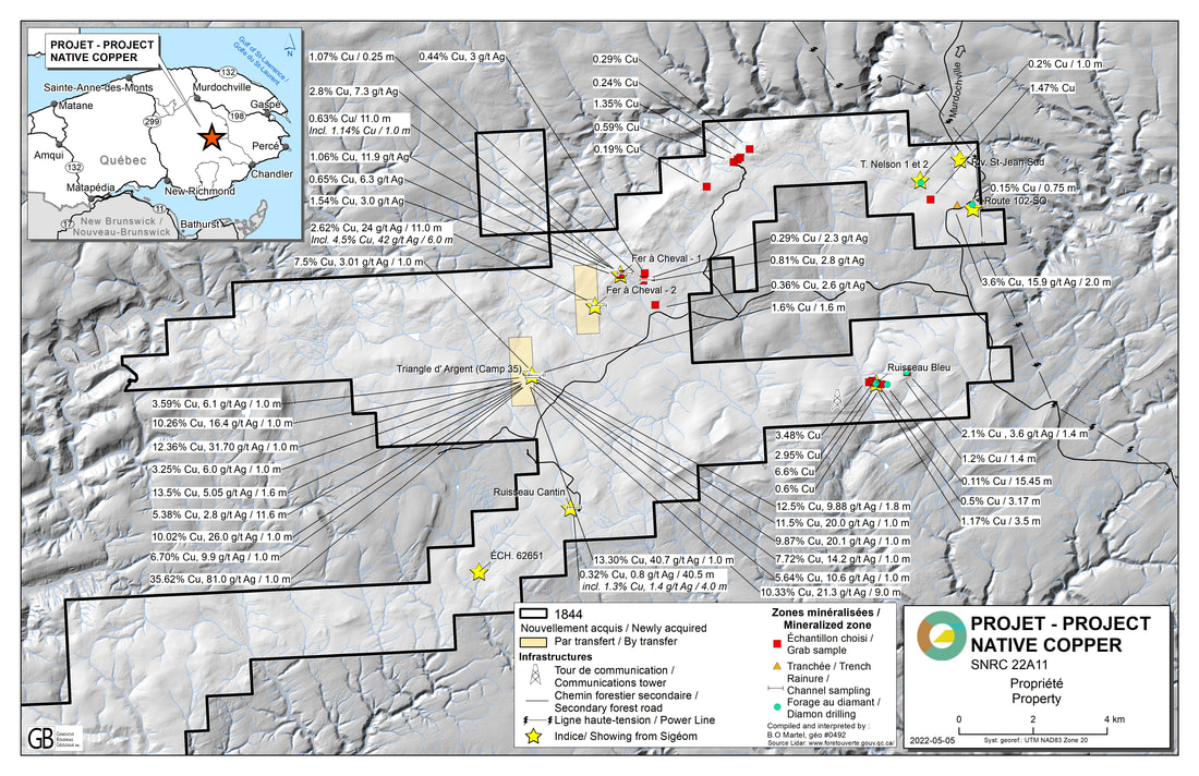
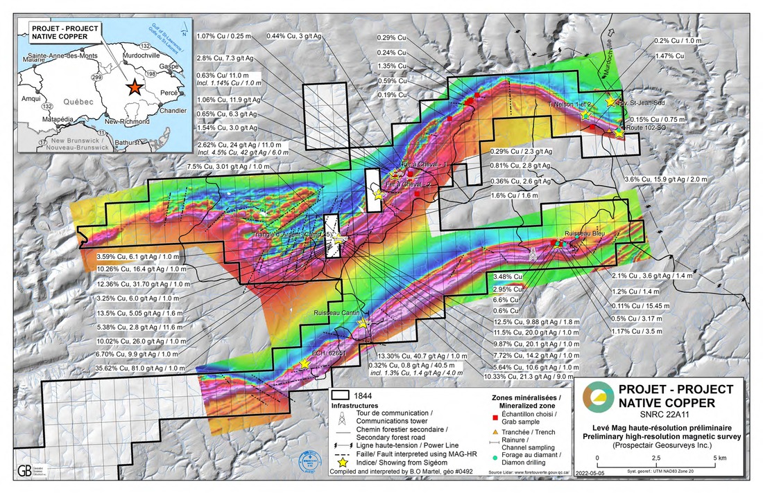
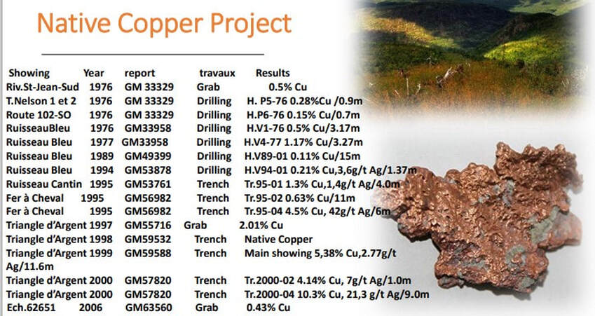
The Native Copper Project, situated west of the Municipality of Chandler, is composed of 295 claims divided in 4 sectors Native Copper South, North-West, North-East and Central and has seven (7) known indicators: Ruisseau Bleu, T.Nelson 1 and 2,Fer à Cheval-1, Ruisseau Cantin,Riviere St-Jean South, Route 102 S-W and Jean-Baptiste Beaudin. The project is part of the Mont Alexandre syncline, associated to an important metallotect volcanic horizon part of the Lake McKay Member, which lies within the greenstone belt present in the Gaspe Peninsula. The Lake McKay Member is situated at the bottom of the West Point Formation and associated to an assemblage of volcaniclastic material, conglomerates and sandstones with some minor interbedded lavas. This type of volcanic horizon is known to generate multiple mineralized copper zone. The greenstone belt has already shown 9 indicators in the area, it appears that the obvious model for these types of mineralization is the Keweenaw Peninsula native copper model
REPORTS
|

|


Maps Press release December 2022
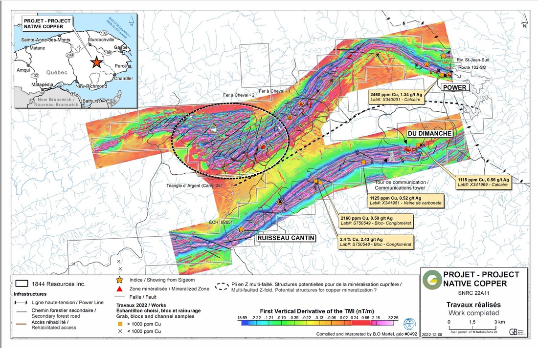
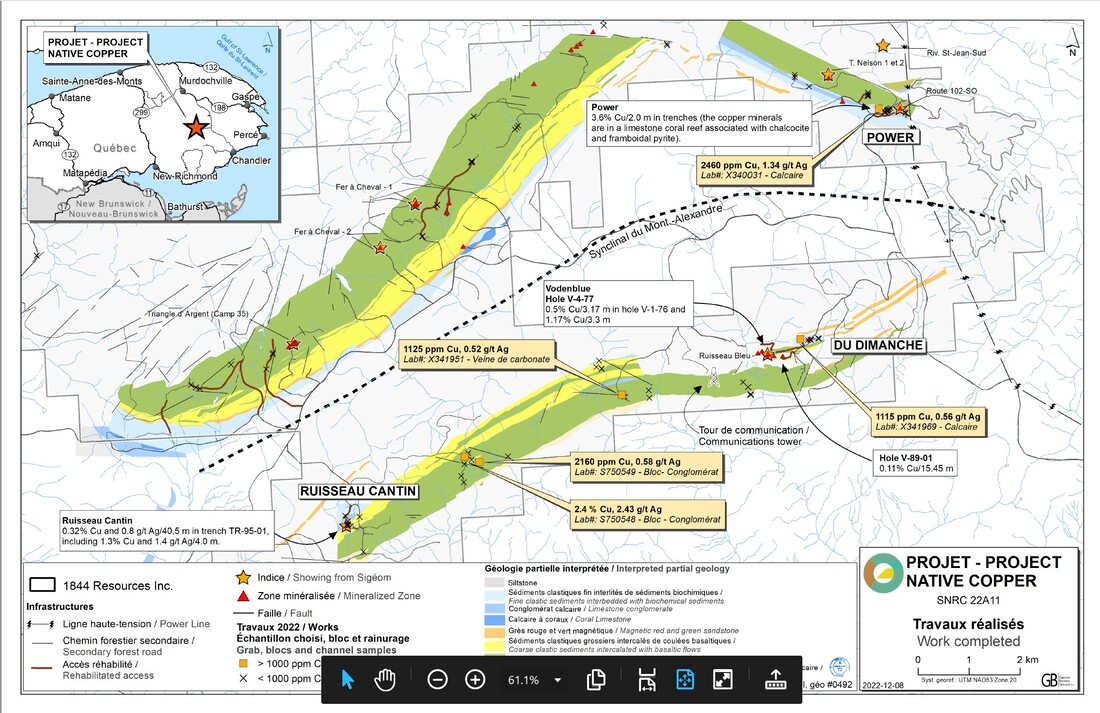
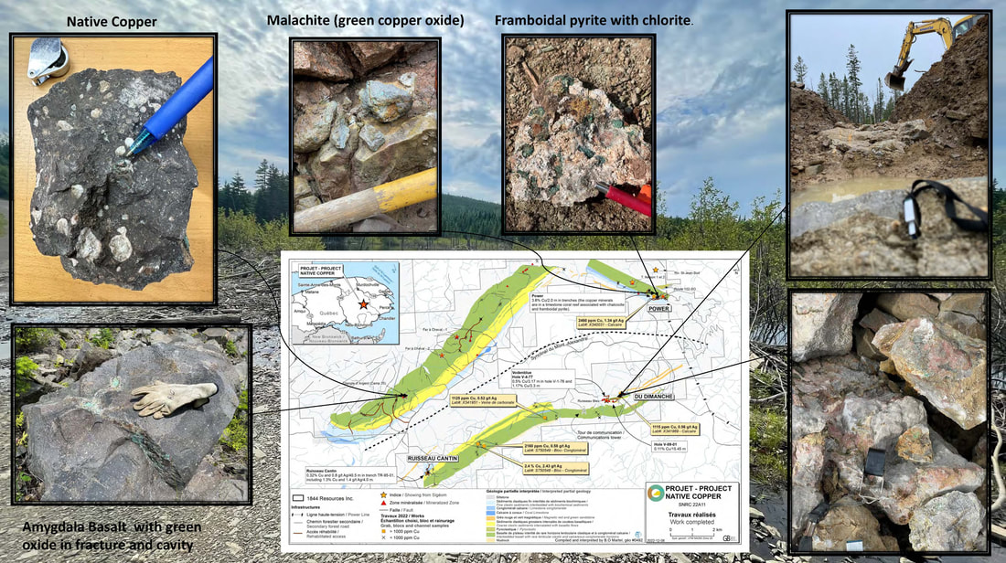
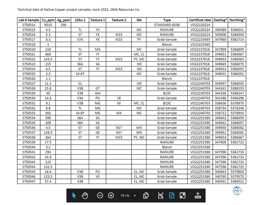
PHOTO GALLERY Summer 2022
MAPS
Qualified Person: Bernard-Olivier Martel, P. Geo, the Company's Director of Exploration, is a qualified person (as such term is defined in National Instrument 43-101 - Standards of Disclosure for Mineral Projects) and has reviewed and approved the technical disclosure contained in this page